Hurricane Humberto and Tropical Storm Imelda significantly influenced weather conditions along the U.S. East Coast, the Bahamas, and Bermuda in late September 2025. These Atlantic storms, though remaining mostly offshore, created hazardous surf and rip currents, demonstrating the dangers posed by powerful systems even without direct landfall.
Hurricane Humberto: Category 5 Strength and Coastal Impacts
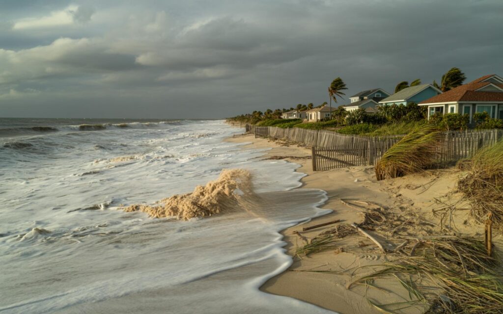
Hurricane Humberto reached Category 5 status during the 2025 Atlantic hurricane season, with peak sustained winds of 160 mph. According to the National Hurricane Center (NHC), Humberto was the second Atlantic hurricane of the season to achieve this intensity. The storm later weakened but maintained a large circulation, generating dangerous surf and strong rip currents along the U.S. East Coast and in the northern Caribbean.
Officials reported that Humberto’s outer bands extended far from the storm center, producing hazardous marine conditions for several days. The NHC issued advisories warning of life-threatening surf and coastal flooding from Florida to the Carolinas.
Tropical Storm Imelda: Rapid Intensification and Bermuda Threat
Tropical Storm Imelda began as a tropical wave east of the Windward Islands. The NHC reported that Imelda organized near Hispaniola and became a named storm southeast of Cape Canaveral, Florida. Imelda intensified to a Category 2 hurricane, with peak sustained winds of 100 mph as it brushed Bermuda before transitioning to an extratropical system.
Imelda brought heavy rain, tropical storm-force winds, and storm surge to the Bahamas before moving northeast. According to the NHC, the storm produced localized flash flooding and rainfall totals of up to 4 inches in parts of the Carolinas. Bermuda was placed under a hurricane warning and experienced hurricane conditions as Imelda passed nearby, while Humberto’s outer bands also affected the island.
Unusual Proximity and Fujiwhara Effect Between Humberto and Imelda
The proximity of Hurricane Humberto and Tropical Storm Imelda was notable. According to the NHC, the two storms came within about 450 miles of each other, making them one of the closest pairs of named Atlantic storms since satellite tracking began. Their interaction, known as the Fujiwhara Effect, influenced Imelda’s track, pulling it away from the U.S. coast and reducing the risk of direct landfall.
Experts at the NHC noted that the Fujiwhara Effect can complicate forecasts and alter expected impacts, as the interaction between nearby storms may change their movement and intensity.
Hazardous Conditions Along the U.S. East Coast
Both Hurricane Humberto and Tropical Storm Imelda produced life-threatening surf, rip currents, and coastal flooding from Florida to the Carolinas. The NHC and local authorities issued warnings for nearly the entire East Coast. According to official reports, at least three fatalities occurred due to rip currents and storm-related incidents in Florida and Cuba.
- Dangerous surf and rip currents affected beaches from Florida to the Carolinas
- Localized flash flooding was reported in coastal areas
- Storm surge and tropical storm-force winds impacted the Bahamas and Bermuda
Storm Evolution and Forecasts
According to the NHC, both storms were forecast to move away from the U.S. and become post-tropical systems by the end of the week. No new tropical formation was expected in the Atlantic in the immediate future. The 2025 Atlantic hurricane season had not seen any hurricanes make landfall in the U.S. up to this point, but the impacts from Humberto and Imelda highlighted the dangers of offshore storms, especially through indirect effects like rip currents and coastal flooding.
Expert Warnings: Offshore Storms Pose Ongoing Risks
Officials emphasize that even when hurricanes and tropical storms do not make landfall, their large size and the swells they generate can create hazardous conditions far from the storm center. The interaction between nearby storms, as seen with Humberto and Imelda, can further complicate forecasts and change expected impacts. The NHC urges residents along the Atlantic coast to monitor official advisories and heed local warnings.
Details may be updated as investigation continues. For the latest information, refer to advisories from the National Hurricane Center.
Frequently Asked Questions About Hurricane Humberto and Tropical Storm Imelda
What were the main impacts of Hurricane Humberto and Tropical Storm Imelda?
Humberto and Imelda caused dangerous surf, rip currents, and coastal flooding along the U.S. East Coast, the Bahamas, and Bermuda. Both storms produced hazardous conditions even though they did not make landfall in the United States.
How did the Fujiwhara Effect influence these Atlantic storms?
The Fujiwhara Effect caused Humberto and Imelda to interact, changing Imelda’s path and pulling it away from the U.S. coast. This reduced the risk of direct landfall and altered the storms’ impacts.
Are offshore hurricanes still dangerous for coastal areas?
Yes, offshore hurricanes like Humberto and Imelda can create strong swells, rip currents, and flooding far from the storm center. Officials advise caution and monitoring of local warnings during such events.
Where did Tropical Storm Imelda become a hurricane?
Imelda became a hurricane southeast of Cape Canaveral, Florida, and reached Category 2 strength as it passed near Bermuda. It brought heavy rain and storm surge to the Bahamas before moving northeast.
Can the Atlantic hurricane season have major impacts without U.S. landfall?
Yes, as seen in 2025, powerful storms offshore can still cause fatalities and significant hazards along the coast. Coastal residents are encouraged to stay informed through official sources.
